
On Thursday, several people on social media claimed that Pakistan is showing the entire Jammu and Kashmir area as part of India. Sharing a screenshot from Pakistan government’s Coronavirus portal, it has been claimed that finally Pakistan has accepted that Kashmir is part of India.
At present Pakistan is illegally occupying the PoK and Gilgit-Balistan regions, and the areas are generally included in the map of Pakistan published by the Pakistani government. Similarly, the same region is also included in the map of India published by India, as the region officially belongs to India.
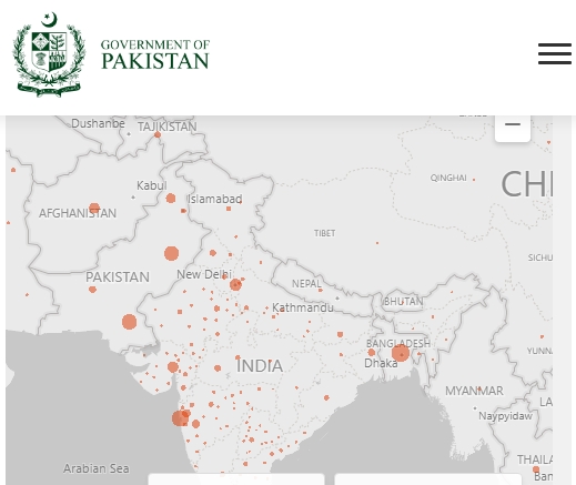
The same was also reported by a portal called The Real Kashmir News. It said that Pakistan Government’s official website on Covid-19, www.Covid.gov.pk has shown Jammu and Kashmir as part of Indian Territory.
But when one goes to the international section of the Covid19 website of Pakistan, one can indeed see that the map shown here is how India projects the map, with the whole of Kashmir shown as part of India. Although it looks like a big development, as a official govt website of Pakistan is carrying this map, actually this does not mean Pakistan has given up their claim on Kashmir. Moreover, the map is showing that way only in India, outside India it shows differently.
This is because, the map shown on the website is not made by the Pakistan government, and they have merely embedded a map created by Microsoft. Tech giant Microsoft has created a Coronavirus database which is projected on their Bing maps. That same map has been embedded in the Pakistan’s Covid portal, which is why the map shows Kashmir in India when viewed from India.
The online maps that we frequently use, like Google Map and Bing Map, are not shown as same in every part of the world. As there are many disputed territories in the world, the same is reflected in the maps, and the maps depending on from where it is being accessed. Generally disputed territories are marked with doted lines, as opposed to normal lines used for non-disputed boundaries. Apart from that, in some cases the map is shown the way it is mandated to be shown in a particular country. As Indian laws mandate that the maps must show the entire Kashmir region in India, the Google and Bing maps comply with that ruling. But when the same maps are viewed from outside India, actually the PoK and Gilgit Balistan as shown as part of Pakistan, and the line of control is shown as dotted lines.
As the Pakistani Covid portal was accessed by Indians from India, the embedded Bing map showed the map as per India. But when it is viewed from outside India, a different map can be seen. This can be verified by accessing the map from outside India. Or the same also can be done by using a VPN (virtual private network) client, which lets one mask their own IP address and allows to set the location to some other country. Thus, one can check how a website is seen in different countries by using a VPN and selecting a country.
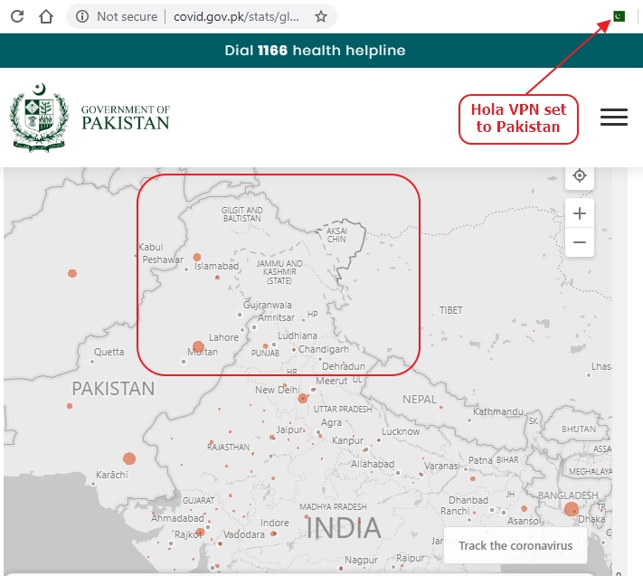
We checked the same by using this technique. First, when visited the page, it indeed showed Kashmir in India. But when we activated our VPN client and set the location as Pakistan, we saw that PoK and Gilgit Balistan are now in Pakistan, Aksai Chin in China, and dotted lines for LoC and LoAC. The same appears when the location is changed to different countries like USA and UK.
The same experiment can be repeated by going directly to Bing’s COVID19 website directly and through VPN, and the same results can be seen.
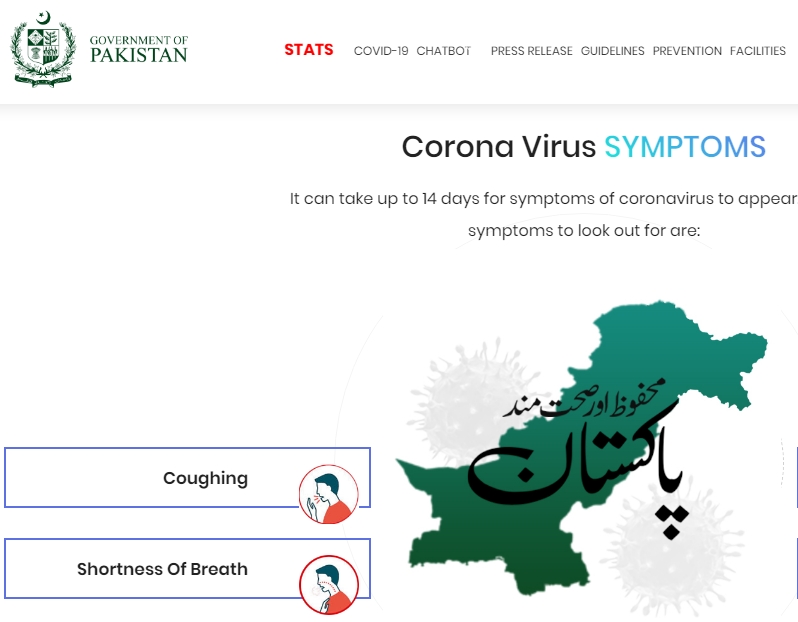
Moreover, the homepage of the portal features a map of Pakistan which shows the usual map that the country uses. They have used an image file as the map which shows PoK and Gilgit Balistan in Pakistan.
Therefore, although it is true that Pakistan’s COVID19 portal shows whole Kashmir India, that is happening only when viewing the portal from India. This is happening because the Pakistan govt has embedded a third party mapping program, they have not created the same. Pakistan govt is not changing their position on Kashmir as evidenced by the map used on the homepage.
