
An ordinary fishing trip turned into an international incident on Monday when an Indonesian fisherman hauled a Chinese unmanned underwater vehicle (UUV) in the waters of the Lombok Strait, a vital maritime chokepoint in the Indo-Pacific.
The fisherman discovered the torpedo-shaped metallic device while casting his nets approximately 10 miles (about 16 km) north of the popular tourist island of Gili Trawangan, in North Lombok Regency, West Nusa Tenggara province. Local media reported that the object, roughly 3.7 meters (around 12 feet) long and cylindrical in shape, was floating in the waters of the North Trawangan Strait.
After the fisherman discovered the drone and pulled it to the shore, the locals immediately reported it to local authorities. Indonesian police and maritime officials secured the device, and a specialised Bomb Disposal and Chemical, Biological, and Radioactive Bomb Squad (Gegana Team) conducted a thorough inspection. After that, it was transferred to the Indonesian Navy’s base in Mataram for detailed examination.
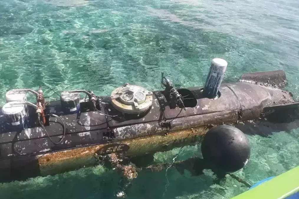
No explosives or radioactive materials were found during initial inspections, authorities confirmed. Therefore, the device has been identified as a surveillance vessel. The drone has various cables, sensors, and a top hatch housing oceanographic research equipment. Analysts, including China technology fellow Ryan Fedasiuk of the American Enterprise Institute, identified it as likely belonging to CSIC’s Haishen family of deep-sea submersibles or a similar reconnaissance UUV.
An official said that it appears that the vessel has an Acoustic Doppler Current Profiler (ADCP), which is a hydro-acoustic current measuring device similar to sonar, used to measure the speed of water currents at a certain depth.
Photographs circulating on social media and published by outlets show a sleek, unmanned device consistent with marine surveillance or oceanographic survey equipment. Markings on the object have been linked to the China Shipbuilding Industry Corporation (CSIC), a major Chinese state-owned defence contractor involved in submarine and underwater technology development. As per reports, the device has some partial Chinese text that can mean either “research and development” or “developed by.”
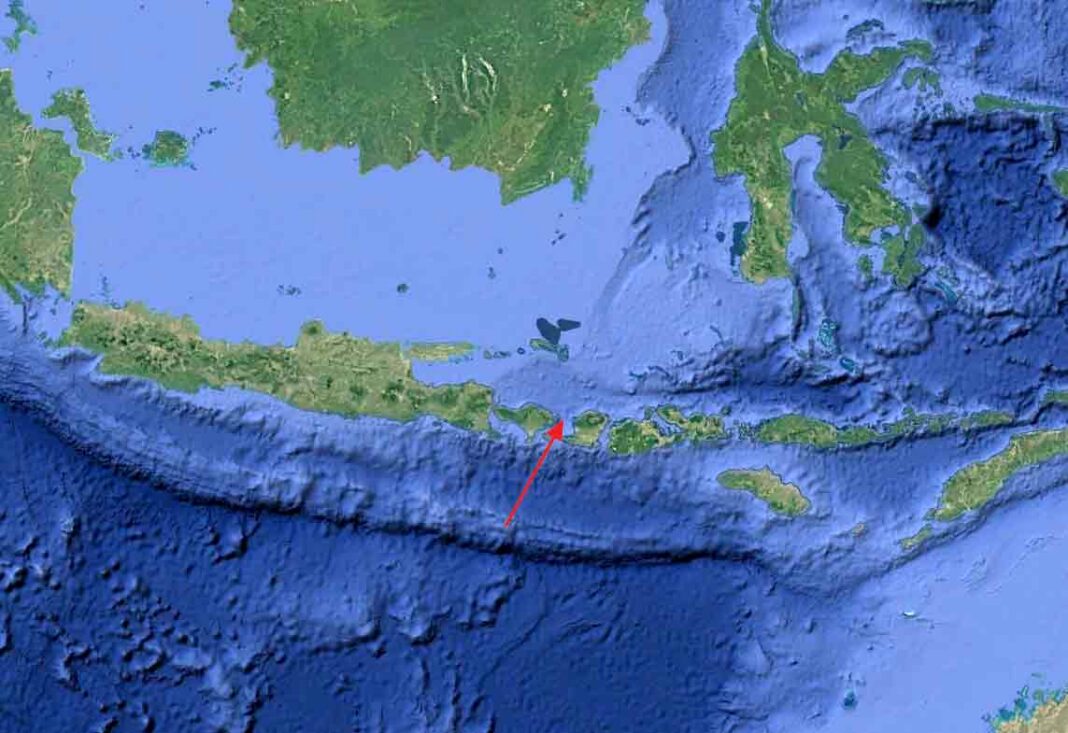
The Lombok Strait between Bali and Lombok is one of Indonesia’s most strategically significant waterways, serving as a deep-water passage connecting the Pacific and Indian Oceans. It is capable of accommodating large naval vessels and submarines, making it a closely monitored route by regional powers, including the United States and Australia. The discovery has raised questions about potential underwater mapping or surveillance activities by China in the region’s sensitive sea lanes.
Indonesian naval authorities have launched a formal investigation to determine the drone’s origin, purpose, and whether it drifted off course or was operating intentionally in Indonesian waters.
Such devices are often used for oceanographic data collection, environmental monitoring, or military reconnaissance, including mapping underwater topography that could aid submarine navigation.