

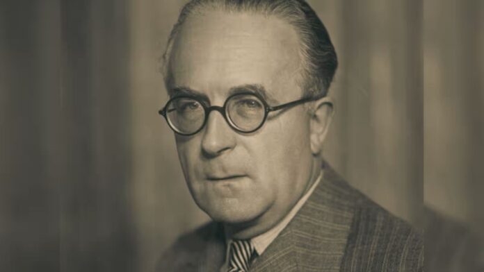
On 15 August 1947, India celebrated freedom, and Pakistan celebrated the birth of a new country. But the man entrusted with deciding where one country would end and the other would begin was already preparing to leave India.
Cyril John Radcliffe had arrived in India only on 8 July 1947. A British barrister with no previous experience of the country, he was given less than six weeks to chair the Boundary Commissions and draw the borders of Punjab and Bengal. The UK National Archives’ account of Partition records that Radcliffe was asked to draw the border lines of the two new nations within six weeks.
The line he produced would divide villages, districts, railway networks, irrigation systems and communities. It would help trigger one of the largest and bloodiest forced migrations in modern history.
And then Radcliffe destroyed most of the papers relating to his private deliberations.
That raises a question that cannot be fully answered today: what exactly did the man who drew the India-Pakistan border think, consider, and decide before putting his final line on the map?
Some of the evidence survives. Much does not.
And the missing evidence is not a minor archival curiosity. It concerns the reasoning behind one of the most consequential territorial decisions of the twentieth century.
A British outsider was given extraordinary power.
Radcliffe was not an Indian administrator who had spent decades studying Punjab and Bengal. He was not a cartographer who had surveyed their terrain. He was not an Indian Civil Service officer familiar with their villages, canals and communities.
He was a barrister.
His lack of prior involvement in Indian politics was considered an advantage, as it could allow him to appear impartial. But there was an obvious downside: the man being asked to divide India did not know India.
He arrived in the subcontinent for the first time on 8 July. Within weeks, he was expected to decide the fate of territory inhabited by tens of millions of people. A recent scholarly study of the Boundary Commission describes the timetable as one in which Radcliffe arrived less than six weeks before the British withdrawal deadline.
This was not merely a cartographic exercise.
The official Punjab Boundary Commission award required consideration of contiguous Muslim and non-Muslim majority areas, but also allowed “other factors” to be considered. Those other factors included administrative boundaries and, in practice, infrastructure such as railways, roads, canals, canal headworks and ports. Radcliffe’s own award explicitly discussed the disruption of railway communications, water systems, canal irrigation and electric power transmission.
The problem was that these systems had been constructed for an undivided province. They did not care about the religious boundary that politicians were demanding.
A canal could begin in one country and irrigate fields in another. A railway could cross the proposed frontier repeatedly. A village could have one religious majority while its economic links lay elsewhere.
Radcliffe was expected to turn this tangled reality into a single international boundary in a matter of weeks.
The Boundary Commission was divided
Radcliffe did not work alone. The commissions included judges nominated by the Congress and the Muslim League. But the Indian and Pakistani members were deeply divided.
That deadlock left Radcliffe with the decisive responsibility.
This is where the conventional image of Radcliffe needs to be examined carefully. He did not simply sit alone with a map and invent a border according to personal whim. He received extensive submissions from both sides, examined census data and considered competing claims. Recent scholarship shows that Congress, Sikh and Muslim League representatives submitted radically different maps and arguments for Punjab.
But the fact that Radcliffe had a difficult assignment does not remove the central problem: the final decision was his, and the time available to make it was extraordinarily short.
The Bengal Commission provides an especially stark example. Radcliffe did not attend its public sittings in person because the Punjab and Bengal proceedings overlapped. Instead, he examined the papers submitted by the parties. Lucy Chester’s 2026 study of the Boundary Commission records that Radcliffe arrived less than six weeks before the withdrawal deadline and examines the extraordinary haste of the process.
That should trouble anyone studying the process, regardless of political affiliation.
A border that was not announced on Independence Day
The Punjab Award was dated 12 August 1947. Yet the boundary awards were not publicly announced until 17 August, after India and Pakistan had already become independent. The National Archives’ Partition material records the enormous displacement and violence that followed the division.
Millions therefore entered Independence Day without knowing precisely where the new international border would run.
By then, communal violence and migration were already underway.
When the line was finally announced, the consequences were immediate. A village assumed to be in India could suddenly find itself in Pakistan. A railway line, canal or market could be cut by an international frontier. Families could discover that their ancestral homes now lay on the other side of a border they had never imagined would exist.
The Radcliffe Line was therefore not simply a line on a map. For millions, it became a decision about whether to stay, flee or risk being trapped on the wrong side.
The British National Archives records the scale of the resulting catastrophe in stark terms, describing mass migration, communal violence, deaths, sexual violence and the destruction of property.
And then Radcliffe destroyed his papers
This is the part of the story that makes the Radcliffe legacy particularly difficult to examine.
Radcliffe destroyed papers relating to his private deliberations after completing his work. Contemporary and later accounts describe the destruction of the Boundary Commission papers in his possession before he left India; a detailed historical account published by The News International records that he left on 16 August after destroying the papers in his possession.
The disappearance of those records does not mean that the entire documentary record of Partition disappeared. The official awards survived. Other officials kept correspondence and papers. Archives still contain material relating to the Boundary Commissions.
But the private trail of Radcliffe’s own reasoning was severely diminished.
That distinction matters.
We can study the final boundary. We can study the census figures. We can read the submissions made by Congress, the Muslim League and other parties. We can examine the official terms of reference.
But we cannot fully reconstruct the private conversation inside Radcliffe’s head as he moved from one possible line to another.
The missing papers therefore created a historical black box.
And it is precisely because the consequences of his decisions were so enormous that the disappearance of that evidence matters.
What was destroyed, and what was not?
It is important not to exaggerate the archival mystery.
It would be wrong to suggest that Radcliffe destroyed every document connected with Partition or that no evidence survives concerning how the Boundary Commission operated. The surviving official record is substantial.
What was lost was the private record of his deliberations.
That means historians can establish many of the factors that shaped the award without being able to answer every question about how Radcliffe personally weighed them.
The distinction also prevents a more serious historical error: treating the missing papers as proof of a conspiracy.
There have long been allegations that political pressure influenced particular territorial decisions, especially in Punjab. The British Library catalogue, for instance, contains statements made decades later by Herbert Christopher Beaumont, Radcliffe’s private secretary, alleging that Lord Mountbatten intervened over the allocation of Ferozepur. Other historical accounts also discuss the reported provisional Ferozepur boundary and the later instruction to “Eliminate Salient”.
That is an important historical allegation.
But it remains an allegation. The existence of Beaumont’s later statement does not by itself establish that Mountbatten dictated the decision, nor does it prove that Radcliffe’s destroyed papers contained evidence of such an intervention.
The proper conclusion is more uncomfortable: we know there were controversies, but the destruction of Radcliffe’s private papers makes it harder to settle some of them conclusively.
Did Radcliffe believe he had done a good job?
There is another revealing aspect of Radcliffe’s later life.
When journalist Kuldip Nayar interviewed him years later and asked whether he was satisfied with the boundary he had drawn, Radcliffe did not claim that it was perfect. Nayar’s published account records Radcliffe’s reflections on the limited time available to him and his subsequent explanation of the decisions.
He said that he had no alternative because the time available was too short to do a better job. Given the same period, he said, he would do the same thing. But if he had been given two or three years, he believed he might have improved upon the result.
This statement can be read in two ways.
It can be understood as a defence: Radcliffe believed he had done the best possible under the circumstances.
But it can also be read as an extraordinary indictment of the circumstances in which the British government had ordered Partition to be carried out.
If two or three years could have produced a better boundary, why was the man deciding the fate of millions given only weeks?
That question leads beyond Radcliffe himself, to the manner in which Britain accelerated the transfer of power and left behind a territorial problem of staggering complexity.
Radcliffe was not responsible for creating Partition, but he was responsible for the line
It would be historically lazy to blame Radcliffe for everything that happened in 1947.
He did not invent the demand for Pakistan. He did not create the communal tensions that preceded Partition. He did not decide, by himself, that British India should be divided. He did not unleash the political and social forces that produced the violence.
But avoiding simplistic blame should not become an excuse for absolving him of responsibility.
Radcliffe accepted the assignment. He chaired the commissions. He examined the evidence. He rejected some claims and accepted others.
And he drew the final line.
His lack of time explains the circumstances. It does not erase the consequences.
The border he produced divided communities and economic systems. Some of its consequences became permanent features of South Asian geopolitics.
The fairest historical assessment is therefore neither to portray Radcliffe as an omnipotent mastermind nor as a helpless clerk who merely followed orders.
He was the British official given an extraordinary responsibility under extraordinary constraints—and the person whose decisions ultimately put the boundary on the map.
What did Radcliffe take to his grave?
Perhaps the most important question is not whether Radcliffe secretly favoured India or Pakistan.
It is what his missing papers might have told us about the process itself.
What did he think when the competing demographic claims pointed one way and irrigation or railway considerations pointed another?
How did he decide between competing maps?
How much weight did he give to political representations?
What did he make of the pressure surrounding the Boundary Commission?
And, most importantly, did he believe the final line was defensible, or merely the least impossible line he could produce before the deadline?
We cannot answer all these questions because much of the private record is gone.
Radcliffe returned to Britain after completing his work and never became a central public figure in the decades that followed. He died in 1977.
But the border he drew survived him.
It survived wars, diplomatic crises, the creation of Bangladesh and generations of India-Pakistan hostility.
The British Empire disappeared. Radcliffe disappeared from public life. The line remained.
That is the enduring irony of his legacy.
The man who spent only weeks deciding where India would end, and Pakistan would begin, left behind a boundary that has shaped South Asian history for nearly eight decades.
And he also left behind a historical mystery of his own making.
The maps survived. The awards survived. The competing claims survived. The memories of those who crossed the border survived.
But much of the private reasoning of the man who drew the line did not.
Perhaps that is why the question remains so compelling.
What did Cyril Radcliffe know, what did he decide, and what did he take with him when he left India?
Some answers remain in the archives. Some remain matters of historical debate.
And some may have disappeared forever, burnt with the papers of the man who drew the border that changed the subcontinent.