

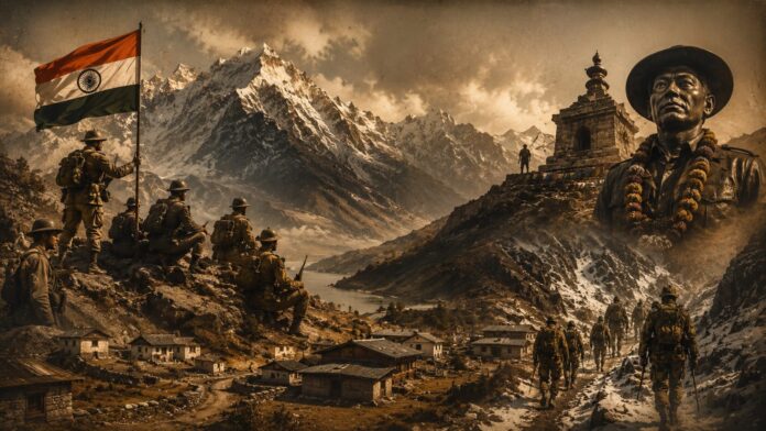
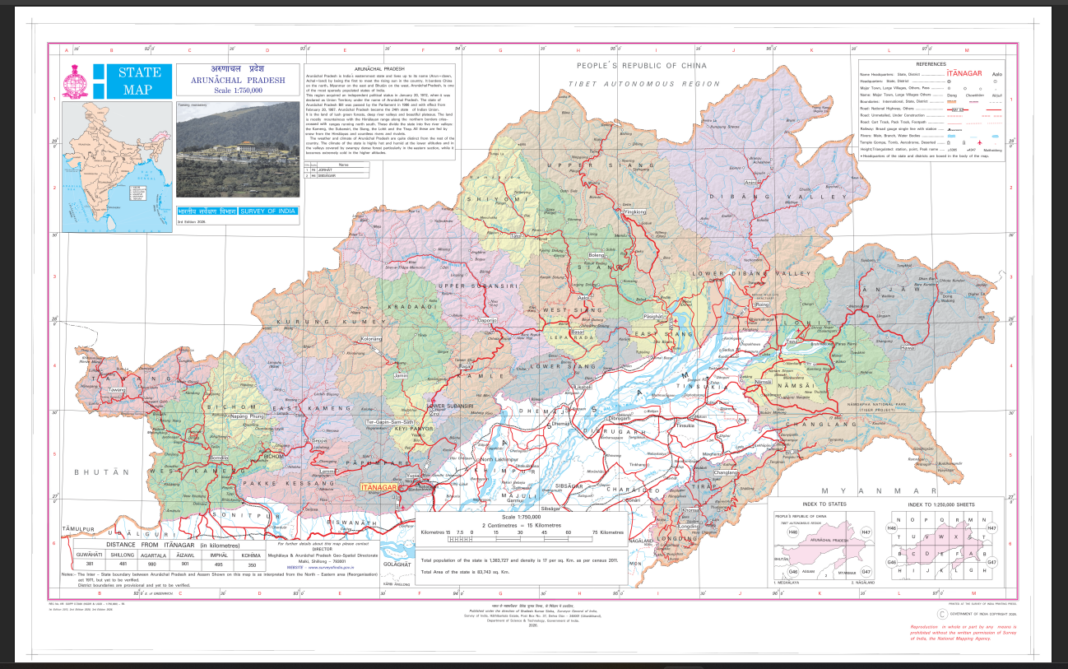
The Government of India has taken a major and historic step regarding border security, administrative identity, and national sovereignty. Under the supervision of the Union Ministry of Home Affairs and after extensive consultations with the Government of Arunachal Pradesh, India’s official mapping agency, the ‘Survey of India’, has included 27 highly crucial and strategic locations of the state in the country’s official national map.
All these places have been recorded with their real, local, and authentic names. This decision comes at a time when neighboring China has been trying for a long time to assert false claims over various places in Arunachal Pradesh by assigning fabricated and fake Chinese names to them.
This step by India is not merely a routine task of entering names on paper, but a highly fitting, institutional, and permanent response to China’s ‘cartographic aggression’ or map-gimmickry.
This move not only grants legal and constitutional strength to the true identity of our remote border areas, but also permanently establishes accurate and correct information among ordinary citizens, the military, and the local administration regarding these regions.
Now let us understand this entire matter in detail, the reasons behind India’s move, the history of these 27 places, and its impact on the international stage.
China’s ‘Rename and Claim’ Agenda and India’s Fitting Counteroffensive
Under a calculated strategy, China has been playing the drama of renaming various areas of Arunachal Pradesh for the past several years by calling it ‘Zangnan’ or ‘South Tibet’.
China’s Ministry of Civil Affairs first released its first list of so-called Chinese names for 6 places in Arunachal in the year 2017. Furthering this sinister plot, it declared fake names for 15 places in 2021, 11 places in 2023, and 30 places in March 2024.
In international affairs, this action of China is referred to as ‘salami slicing’ and ‘cartographic aggression’. Under this, China attempts to prove to the world through paper-based confusion that these areas have historically been under its control.
The Government of India has outright rejected these actions of China every time, clearly stating that writing fake names on paper by another country will not alter the ground reality of Arunachal.
From the Pages of History: The First Clash of 1959 and the Main Centers of the 1962 War
Among the 27 places included in the Survey of India’s new map, several have a deep connection with the history of the India-China border dispute. The most prominent and historic name among these is ‘Longju’, located right near the Line of Actual Control (LAC).
Longju is the very historical site that became the first major military clash point between the two countries in 1959- three years before the 1962 India-China War- when the Chinese military attempted to intrude into Indian territory. Near Longju, the village of ‘Maja’, located in the Upper Subansiri district, has also been prominently featured on the official map.
Additionally, the ‘Thag La’ pass located in the western sector is another highly sensitive part of this entire list. The Thag La pass and the nearby Namka Chu valley are the areas from where China launched a large-scale attack on India on October 20, 1962.
Along with these two historic places, extremely rugged and high-altitude passes such as ‘Dzo La’, ‘Riza La’, and ‘Pukur La’ have also been given a place on the map. These passes are considered vital for movement, surveillance, and patrolling by the Indian security forces.
However, India has now moved beyond mere statements and diplomatic protests to take proactive action. By recording these 27 places in the Survey of India’s map with their real Indian names, India has completely deflated China’s fabricated claims.
Symbols of Valor: The Heroic Tales of Jaswant Singh and Trilok Singh Thapa
The list issued by the Government of India includes not just mountains, rivers, and passes, but also the memorials of those brave sons of Mother India who sacrificed everything while protecting the country’s borders. ‘Jaswant Garh’, located en route to Tawang, has been officially recorded in this list.
Jaswant Garh serves as a reminder of the unmatched bravery of Rifleman Jaswant Singh Rawat (Maha Vir Chakra), the immortal hero of the 1962 war. He single-handedly held off an entire detachment of the Chinese army for 72 hours, attaining martyrdom only after neutralizing dozens of enemies.
Even today, the Indian Army and locals revere Jaswant Garh like a sacred temple. Similarly, the ‘Sher-e-Thapa Memorial’ built in the upper region has been given formal placement on the Survey of India map.
This memorial symbolizes the extraordinary valor of Subedar Trilok Singh Thapa and his brave unit, who gave a fitting reply to the Chinese army near the Subansiri sector in the 1962 war. Including these war memorials in the country’s map sends a direct message that India honors every inch of its border and the sacred land of its martyrs.
Army Supply Routes and Protection of Local Settlements
Several places added to the map serve as the backbone for the administrative functioning of Arunachal Pradesh, the lives of the local tribes living there, and the logistics management of our military. For instance, the name ‘Jairampur’, located in Changlang district, is specially included in this list.
Jairampur is a major strategic hub for the movement of security forces, as well as the supply of rations and military equipment towards eastern Arunachal Pradesh and the Myanmar border.
Similarly, administrative areas like ‘Kamlang Nagar’ in Lohit district, situated near the famous Kamlang Wildlife Sanctuary, and ‘Sunpura’ have been given firm recognition on the official map. Apart from this, a breathtaking and high-altitude natural lake named ‘Sambho Sarovar’ has been included in this list.
Furthermore, inhabited villages such as Bisa, Bara Kundan, Chota Kundan, Dhan Bari, Preetnagar, Bauddhamandir, Teritnagar, Ramnagar, Sagar, Padma, Jyotinagar, Baisakhi, Chota Ropuk, Bara Ropuk and Shivaji Nagar have been marked with their authentic names.
Adding all these villages to the map accords both security and honor to the local tribal communities and their traditional identity.
Legal Power: India’s Strongest Shield Against Paper Claims
For any independent and sovereign nation, its official map is not merely lines of geography, but the strongest proof of its constitutional sovereignty, administrative control, and legal rights.
When the agency responsible for preparing India’s official map- the Survey of India- records a place in its map with an authentic name, it gains legal recognition at both national and international levels.
The first major benefit will be that in all official documents of India, land records, development plans, revenue accounts, and military operations, only these genuine names will be used, leaving no room for any future confusion.
The second major benefit will be that whenever China attempts to make false claims on international platforms or at multilateral meetings based on its fabricated maps, India will possess concrete proof in the form of its official, gazetted, and scientifically surveyed maps.
Experts note that this move demonstrates that India, rather than remaining purely defensive, is now asserting its borders and rights with great strength.
Complete Account of the 27 Places: Passes, Lake, Memorial, and 21 Villages
In this new and updated map released by the Survey of India, a total of 27 important geographical sites have been featured, which can be understood by dividing them into four main categories.
The first category includes four major mountain passes: Dzo La, Riza La, Pukur La, and Thag La. The second category features a natural water body- the high-altitude sacred lake, Sambho Sarovar.
The third category includes the historic Sher-e-Thapa Memorial, reminding us of the bravery of our courageous soldiers.
The fourth and largest category comprises 21 different inhabited villages, administrative areas, and settlements, including Longju, Maja, Bisa, Bara Kundan, Chota Kundan, Dhan Bari, Preetnagar, Bauddhamandir, Jairampur, Teritnagar, Ramnagar, Jaswant Garh, Sagar, Padma, Jyotinagar, Baisakhi, Chota Ropuk, Bara Ropuk, Shivaji Nagar, Sunpura, and Kamlang Nagar.
All these 27 locations have been registered in the national survey network along with their precise latitude-longitude coordinates and authentic Indian names, ensuring that no foreign power can alter their identity in the future.
By adding these 27 locations of Arunachal Pradesh to the country’s official national map, India has delivered a very clear and stern message to China and the entire world.
India has once again made it clear that Arunachal Pradesh was, is, and always will be an integral, indivisible, and inseparable part of India.
Along with the construction of new all-weather roads, tunnels, bridges, and Advanced Landing Grounds in border regions, the ‘Vibrant Villages Programme’, and now this fortification through maps, India’s strong and unambiguous foreign policy is clearly visible.