

HomeGovernment and PolicyLinking India's rivers Part III: Ambitions Vs challenges, and how similar plans have been...

Linking India’s rivers Part III: Ambitions Vs challenges, and how similar plans have been carried out in other nations

Integration with decentralised water management: The river-linking scheme must mandatorily be linked with the country's 'Amrit Sarovar Abhiyan', check dams built under MGNREGA, and the revival of traditional ponds and stepwells. Large dams should only serve as backups; local water harvesting must be the first line of defence.

Whenever there is talk of the ‘Interlinking of Rivers‘ (ILR) campaign in India, the center of discussion often remains the Ken-Betwa Link Project (KBLP), because it is the country’s first model project to reach the ground level. However, the scope of the actual plan of the National Water Development Agency (NWDA) is not limited to Bundelkhand in Central India.

The ultimate and comprehensive goal of the NWDA is to reorganize the hydrological map of the entire country and interconnect all big and small rivers of India through a shared ‘National Water Grid’.

Under this mega plan, a total of 30 inter-basin water transfer links have been proposed across India. The core philosophy of these 30 massive projects is that during the 100 to 120 days of the monsoon, billions of litres of fresh water from rivers that cause destructive floods and flow wastefully into the sea should be checked and diverted to far-flung areas of the country that crave every single drop of water for eight months of the year.

Based on India’s geographical and geological structure, this entire blueprint is divided into two clear components: 1. Peninsular Component (16 River Link Projects) and 2. Himalayan Component (14 River Link Projects).

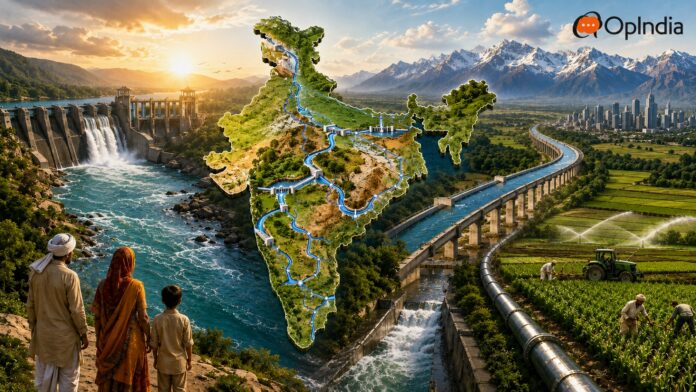
Representational image of India’s river linking mega project, Data: NWDA (Photo Credit: AI ChatGPT)

While China’s South-North Water Transfer Project and America’s California State Water Project have proven that large-scale water transfer can eliminate national-level water crises, India faces unique challenges, including geographical disparities, inter-state water disputes, massive human displacement, and fragile ecology.

In the third and final part of this report based on the River Linking Project, we will conduct an in-depth analysis of all remaining major projects in India, official proposals underway in northwest India following the Indus Waters Treaty, the world’s 5 largest water transfer models, environmental crises, and the final conclusion on whether this scheme will become India’s future ‘Water Revolution’ or prove to be the most difficult and sensitive national project in the country’s history.

Peninsular component of the river linking project: 16 proposed links

The Peninsular Component of India’s ambitious river-linking project primarily focuses on the rivers of central and southern India and streams originating from the Western Ghats. A total of 16 inter-basin links are proposed under this component, whose main objective is to lift the monsoon ‘surplus’ water from massive rivers like the Mahanadi and Godavari in Odisha and Andhra Pradesh and convey it to the water-stressed rivers of South India – Krishna, Pennar, Cauvery, Vaigai and Gundar.

Major River Link Projects of South India

Prominent among these is the Mahanadi – Godavari – Krishna – Pennar – Cauvery – Vaigai – Gundar Grid aimed at the south of India. This is the largest water grid binding South India together. It mainly includes the following links:

Mahanadi (Manibhadra) – Godavari (Dowlaiswaram) Link: Transferring the water that causes heavy havoc during monsoon in Odisha’s Mahanadi into the Godavari River through barrages and canals stretching over 800 km long.

Godavari (Inchampalli/Polavaram) – Krishna (Nagarjunasagar/Vijayawada) Link: Diverting the massive water flow of the Godavari into the Krishna River via Andhra Pradesh and Telangana.

Krishna (Almatti/Srisailam/Nagarjunasagar) – Pennar (Somsila) Link: Taking Krishna’s water through the arid regions of Rayalaseema and Karnataka to the Pennar River.

Pennar (Somsila) – Cauvery (Grand Anicut) Link: Conveying water from Andhra Pradesh to the Cauvery Basin in Tamil Nadu.

Cauvery (Kattalai) – Vaigai – Gundar Link: Taking Cauvery’s water to the southernmost and driest districts of Tamil Nadu (Madurai, Ramanathapuram).

If this grid is fully constructed, it can significantly reduce the Cauvery and Krishna water disputes that have been going on between Tamil Nadu, Karnataka, Andhra Pradesh and Telangana for the past hundred years, as the southern states will start receiving additional water from northern rivers.

River Link Projects of Central India (Priority Links of Central India)

Parbati – Kalisindh – Chambal Link: Along with Ken-Betwa, this link has been prioritised to provide irrigation and drinking water supply to the Malwa region of Madhya Pradesh and the Hadoti and Chambal regions of Rajasthan (Kota, Bundi, Jhalawar).

Damanganga – Pinjal Link: Diverting the water of the Damanganga River flowing on the border of Gujarat and Maharashtra through the Vaitarna and Pinjal rivers to the Mumbai Metropolitan Region. Its primary objective is to meet the drinking water demand of India’s financial capital, Mumbai, until the year 2050.

Par – Tapi – Narmada Link: Diverting the water of rivers originating from the Western Ghats of South Gujarat (Par, Tapi) into the main canal network of Narmada to deliver water to the ultra-arid regions of North Gujarat, Saurashtra, and Kutch. However, work on this is currently stalled due to strong opposition from local ST communities.

Diverting water of Western Ghats rivers eastward

Netravati – Hemavati Link: Diverting the water of the Netravati River, which flows through the Western Ghats into the Arabian Sea in Karnataka, into Cauvery’s tributary Hemavati so that farmers in Bengaluru and Southern Karnataka can get water. This project is likely to be dropped due to a changed surplus water projection.

Bedti – Varada Link: Resolving the water crisis in Uttara Kannada and Dharwad districts of Karnataka.

Pamba – Achankovil – Vaippar Link: Taking the water of Kerala’s Pamba and Achankovil rivers to the dry Vaippar basin of Tamil Nadu (which the Kerala government is continuously opposing).

Analysis of the Himalayan component

The Himalayan Component is the largest, technically complex, and engineering-wise more challenging part of the entire inter-basin water transfer plan. A total of 14 links have been proposed under this. Its main part is to control the water of perennial and surging rivers flowing from Nepal, Bhutan, and Northeast India (Assam, Arunachal) and convey it to the western and southern parts of the country.

Fact Box, Photo Courtesy: AI ChatGPT

Manas – Sankosh – Teesta – Ganga (M-S-T-G) Link

This project is the backbone of the National Water Grid. It is the largest, most expensive, and most far-reaching proposal of the entire river-linking scheme.

In this project, the water of Manas and Sankosh rivers of Bhutan and Northeast India, which have abundant water, will be dammed by constructing a massive barrage in Assam and fed into the Ganga River near Bihar (above Farakka Barrage) via West Bengal’s Teesta River through a ‘Super Canal’ stretching over 700 kilometers long.

Under this single link, there is a plan to transfer approximately 43,000 Million Cubic Meters (MCM) of water per year, which is even more than the total annual flow of many small rivers in India.

This canal will pass through the ‘Siliguri Corridor’ (Chicken’s Neck) connecting Northeast India to mainland India, which will multiply navigation and logistics capabilities for security forces in the Northeast.

Link Network of Ganga and Its Tributaries

  • Kosi – Ghaghara Link: Constructing a massive high dam on the Kosi River, originating from Nepal and known as the ‘Sorrow of Bihar’ for causing devastating annual floods, to convey its water to the Ghaghara (Saryu) River in Uttar Pradesh.
  • Gandak – Ganga Link: Diverting Gandak River water to strengthen the Middle Ganga Basin.
  • Ghaghara – Yamuna & Sarda – Yamuna Links: Diverting water from the Sarda (Mahakali) and Ghaghara rivers on the Nepal-Uttarakhand border through massive canals into the Yamuna River above Haryana and Delhi. This will revive the disappearing flow of Yamuna and permanently resolve the drinking water crisis of Delhi-NCR.

Linking grid of Northwest India

  • Yamuna – Rajasthan Link: Drawing water from the Yamuna River to carry irrigation canals to Churu, Jhunjhunu, and Bikaner districts of Rajasthan.
  • Rajasthan – Sabarmati Link: Extending Rajasthan’s water to Gujarat’s Sabarmati River to irrigate the entire desert belt of Western India.
Detailed study chart of India’s river linking project, data: NWDA (Photo Credit: AI ChatGPT)

Official proposals related to Himachal-Punjab-Rajasthan and Jammu & Kashmir (In Context of the Indus Waters Treaty)

River management in Northwestern India is not merely an issue of agriculture or drinking water, but has been an extremely sensitive subject of national security and international diplomacy.

Under the ‘Indus Waters Treaty’ (IWT) signed between India and Pakistan in the year 1960, the rivers were divided, in which:

  • Eastern Rivers: India was given complete and exclusive rights over the entire water of Ravi, Beas, and Sutlej.
  • Western Rivers: Most of the water of Indus, Jhelum, and Chenab was allocated for Pakistan’s use, although India received limited rights to build ‘run-of-the-river’ hydroelectric projects on them.

Despite India having full rights over the eastern rivers (Ravi, Beas, Sutlej), for decades, in the absence of adequate dams, barrages, and canal networks, an average of 2 to 3 Million Acre Feet (MAF) of fresh water belonging to India used to flow unutilized into Pakistan via the Ravi River.

In recent times, especially after the Pahalgam attack, the Government of India launched Operation Sindoor on one hand and put the Indus Waters Agreement on hold on the other. Following this, the Central Government framed an official policy and prioritised work on three major infrastructure projects to maximise water utilisation in India.

Shahpurkandi Dam Project (Punjab): This project is located on the Ravi River in Pathankot district of Punjab. The Shahpurkandi Dam project is downstream of the famous Thein (Ranjit Sagar) Dam. With the completion of this dam’s construction, the water of the Ravi River that used to flow into Pakistan has been completely stopped. This saved water has immediately started providing irrigation water to 32,000 hectares of agricultural land in Punjab as well as 1,150 hectares in Kathua and Samba districts of Jammu & Kashmir.

  • Ujh Multipurpose Project (Jammu & Kashmir): This project is underway on ‘Ujh‘, a major tributary of the Ravi, in Kathua district of Jammu & Kashmir. A massive water storage of approximately 781 MCM is being created in this project with an estimated cost of ₹9,167 crore. This will irrigate 31,380 hectares of land in Kathua, Samba and Jammu districts of Jammu & Kashmir and generate 186 MW of hydroelectricity.
  • Ravi-Beas-Sutlej Link and Rajasthan Canal (Indira Gandhi Canal): Water conserved from the Ravi and Beas rivers is being diverted into the Indira Gandhi Canal via Harike Barrage. This has accelerated water flow to the Thar Desert of Rajasthan (Jaisalmer, Barmer, Bikaner, Sri Ganganagar), transforming a large portion of the barren desert along the India-Pakistan border into lush green fields.

While India has started serious talk around river-linking only in recent times, there are many examples around the world where river linking has been carried out on a large scale, ensuring water abundance for major areas.

World’s 5 Largest successful water transfer models

Inter-Basin Water Transfer is not a new or uniquely Indian experiment. Several countries across the world have built massive engineering structures to deal with their geographical disparities, droughts, and industrial needs. We are briefly outlining 5 such projects from around the world.

Data from open sources, photo courtesy: AI ChatGPT

It is extremely important for India to understand these global examples:

China’s South-North Water Transfer Project (Nan Shui Bei Diao): The southern part of China (Yangtze River Basin) is water-rich, while its northern part (Yellow River Basin, where industrial cities like Beijing and Tianjin are located) was facing a severe water crisis.

This is the largest water transfer project in world history. It includes 3 major canal routes (Eastern, Central, and Western Routes), with a total length of over 4,350 kilometers.

Pic: Social Media

The cost of this project has been over $62 billion, transferring approximately 44.8 billion cubic meters (BCM) of water annually from southern rivers to the north. This project quenched the thirst of China’s capital, Beijing, and completely halted the declining groundwater levels in North China.

America’s California State Water Project (CSWP): In fact, the U.S. state of California is divided into two contrasting parts. Northern California receives 70% of rainfall and snowfall, while 80% of water demand (agriculture and cities like Los Angeles) lies in Southern California.

Under this project launched in the 1960s, a 1,129-kilometer-long ‘California Aqueduct’, 34 major dams, 20 lift pumping stations, and dozens of powerhouses were built. Water is lifted to a massive height of 593 meters over the Tehachapi Mountains.

Official map from the California State Water Project, courtesy: water.ca.gov

This project transformed Southern California into the world’s largest and richest fruit and vegetable-producing agricultural belt.

Pakistan’s Indus Basin Irrigation System (IBIS): Following the 1960 Indus Waters Treaty, when eastern rivers were allocated to India, the irrigation system in Pakistan’s Punjab and Sindh provinces faced the threat of collapse. Thus, with the help of the World Bank and international funding, Pakistan launched the ‘Indus Basin Project‘. Under this, two of the world’s massive earth-fill dams – Tarbela Dam (on the Indus River) and Mangla Dam (on the Jhelum River) were constructed. Pakistan built 8 massive inter-river link canals to transport water from the Indus and Jhelum to the plains of the eastward-flowing Chenab, Ravi, and Sutlej.

Today, it is the world’s largest integrated canal irrigation system. However, Pakistan is unable to properly utilise this large system, and numerous flaws have emerged in its operation.

Spain’s Tagus-Segura Water Transfer Project: The northwestern part of Spain (Tagus River) is quite wet and mountainous, while the southeastern part (Segura River Basin) is extremely dry and semi-deserted. Thus, in this 286-kilometer-long canal system completed in 1979, water was channeled across the Betic mountains via tunnels and aqueducts into the Segura basin.

This project transformed the southern Spanish regions of Murcia and Alicante into the ‘Orchard of Europe’.

Australia’s Snowy Mountains Scheme: The fresh water of the ‘Snowy River’, originating from Australia’s snow-capped mountains, used to flow eastward wastefully into the Pacific Ocean, while Australia’s western interior (Murray-Darling Basin) suffered from drought. Thus, in this massive engineering marvel built between 1949 and 1974, 145 kilometers of underground tunnels across mountains, 16 major dams and 7 hydro power stations were constructed.

It diverted the Snowy River water into the Murray-Darling Basin, breathing new life into millions of acres of new wheat and cotton fields in Australia and generating massive amounts of hydroelectricity.

Photo courtesy of the official website of the Snowy Mountains Scheme project.

Apart from this, several projects are underway in different parts of Australia. Additionally, the Danube River project spans multiple countries.

What are the lessons for India from international models?

Upon an in-depth study of these 5 major global water transfer models, 5 very clear and practical lessons emerge for India’s policy makers, hydrologists and engineers:

Political consensus and transparent laws: The California model in the US and the Spanish model clearly show that until there is a transparent division of legal and financial benefits between the donor basin and the recipient basin, disputes do not end. Political tussles between the Tagus and Segura basins still continue in Spain today. India needs a strong, constitutional and universally acceptable national authority to resolve inter-state water disputes.

Long-term financial and technical patience: Whether it is China’s South-North Project or Australia’s Snowy Mountain Scheme, these projects took a long period of 20 to 50 years to complete. India must understand that 30 links cannot be completed simultaneously in a few years. This strictly requires a phased approach and continuous budget allocation.

Protecting downstream ecosystem: The experiences of Spain and Pakistan taught the world that when more than 50% of a river’s water is diverted, the downstream ecosystem dies, leading to salinity intrusion into agricultural fields. India should lift only as much ‘surplus’ water from any river as keeps the river’s minimum environmental flow uninterrupted.

Modern lifting and tunnelling technology: The massive lift pumps built by the USA to lift water over the Tehachapi Mountains are marvellous feats of engineering. India’s Himalayan and Peninsular components include mountain ranges like the Western Ghats and Vindhyachals. India will have to rely on modern, eco-friendly Tunnel Boring Machines (TBMs) for lifting water and digging tunnels.

Multipurpose utility: Australia’s project was not just for irrigation; it provided cheap hydroelectricity to the entire country, enabling fast cost recovery of the project. Hydroelectricity and inland waterways must be mandatorily linked to all 30 links in India.

Environment, climate change and expert’s arguments

The River Linking Scheme is one of the most debated policies in India’s history. The country’s scientists, economists, bureaucrats, and environmentalists are divided into two clear and opposing camps. On one side is government support, while on the other side, critics especially the NGO lobby are constantly trying to impede these projects. We also explained this in detail in the second part of our 3-part special series.

Arguments of supporters and policy makers

  • Food & Water Security: India’s population is estimated to reach around 1.6 to 1.7 billion by the year 2050. To feed this massive population, India will need 450 million tonnes of food grains. Only the 35 million hectares of additional irrigation potential generated by the 30 links can save the country from starvation.
  • Permanent Flood & Drought Mitigation: Assam, Bihar, and Eastern UP suffer an average structural loss of ₹20,000 crore every year due to floods. Checking floodwaters and directing them to dry Marathwada, Bundelkhand and Thar will resolve both national problems.
  • Clean Energy Generation: Approximately 34,000 MW (34 GW) of hydroelectricity will be generated from the proposed 30 links. This green electricity will help India reduce its carbon emissions and decrease dependence on thermal power plants.
  • Cheap Waterways (Inland Navigation): The large network of link canals can be developed as National Waterways, making freight transport 80% cheaper compared to trucks and trains.

Arguments of critics and environmentalists against the projects

Massive forest destruction and loss of biodiversity: 5,803 hectares of forest in Panna Tiger Reserve is submerging in the Ken-Betwa link project. If all 30 links are built, lakhs of hectares of dense forests, wildlife sanctuaries, and extremely rare biodiversity across the country will be submerged.

Displacement of millions of villagers: According to estimates, 1.5 to 2 million people will be displaced due to the construction of reservoirs and canals for the 30 links, most of whom belong to society’s most underprivileged ST communities. The history of displacement in India (such as the Narmada Bachao Andolan) shows that rehabilitation policies always remain confined to paper.

Destruction of the river’s natural character: Waterman Rajendra Singh believes that ‘a river is not merely a flowing pipe of water’. A river is a living ecosystem. When we draw water from a river, seawater encroaches upon its estuary, rendering coastal lands barren.

Global warming and Monsoon uncertainty: Due to climate change, monsoon rainfall patterns are changing rapidly. A river basin that NWDA currently considers ‘surplus’ may itself become ‘deficit’ in the next 30 years due to global warming and melting glaciers. In such a scenario, these massive concrete structures costing over ₹10 lakh crore could prove useless.

Neglect of traditional water conservation methods: Critics believe that instead of spending lakhs of crores on massive dams, if India revives its more than 500,000 traditional ponds, stepwells, check dams, and rainwater harvesting systems, India’s thirst could be quenched at 10% of the cost.

The way forward

India cannot ignore its water challenges, but it also cannot blindly erect destructive concrete structures. India must adopt a very subtle and balanced middle path between ‘Engineering and Ecology’.

5 key strategic suggestions for the River Linking Project

Prioritize intra-state links First: Instead of getting entangled in inter-state disputes, the government should first work on links that fall within the boundaries of a single state (such as the Kosi-Mechi link in Bihar or the Cauvery-Vaigai link in Tamil Nadu). These face neither legal hurdles nor inter-state disputes. However, the Ken-Betwa project faces no such obstacles and the Government of India is completing it on a priority basis.

Integration with decentralised water management: The river-linking scheme must mandatorily be linked with the country’s ‘Amrit Sarovar Abhiyan’, check dams built under MGNREGA, and the revival of traditional ponds and stepwells. Large dams should only serve as backups; local water harvesting must be the first line of defence.

Water use efficiency in agriculture: More than 80% of India’s water is spent solely on agriculture. If India mandates micro-irrigation techniques such as drip irrigation and sprinklers instead of flood irrigation, we can irrigate millions of additional acres of land without building any new dams.

  • Independent scientific and social impact assessment: Before greenlighting any link, an unbiased study on climate change impacts should be conducted by IITs, the Indian Institute of Science (IISc), and independent environmental organisations. However, the Government of India has been adopting such evaluation policies for all projects.
  • Transparent and humane rehabilitation laws: Just as with the Daudhan Dam, it must be mandatory to provide cultivable land, permanent employment, and dignified civic amenities to displaced persons before a project begins. The Government of India is doing remarkable work in this direction as well.
Image based on open source data (Photo Credit: AI ChatGPT)

Will this become India’s water revolution or the toughest challenge?

Standing in the middle of the 21st century, India today finds itself at a major historical and moral crossroads. On one hand, we face the basic needs of over 1.4 billion citizens, drying wells, dying cities, and India’s vast rural economy dependent on the mercy of the Monsoon. On one hand, there are dry, drought-prone areas, while on the other, the vast lands are inundated with flooding every year, causing devastating loss of life and property.

This massive ‘Interlinking of Rivers‘ scheme by the National Water Development Agency (NWDA) is undoubtedly the boldest, and largest engineering concept in the history of independent India. If implemented merely as a ‘project to build concrete dams and canals’, this scheme will end up becoming a new vector for bureaucratic negligence, compensation scams, endless inter-state court litigation, and catastrophic environmental havoc.

Conversely, if the Central Government and State Governments rise above party politics, learn from the technical experiences of China and the US, and implement it in a phased manner with strict environmental standards, modern technology, transparent social rehabilitation, and human empathy, this scheme will undoubtedly prove to be India’s greatest ‘National Water Revolution’ in the 21st century.

This project will not merely connect two rivers or two states, but will perform the historic task of weaving India’s golden future, food security, economic prosperity, and national integrity into an unbreakable thread. The decision lies in our hands as to how we utilize this massive engineering capability in balance with nature to turn our thirsty land green.

(Note: Click here to read Part I of this series. Click here for Part II.)

Join OpIndia's official WhatsApp channel

  Support Us  

For likes of 'The Wire' who consider 'nationalism' a bad word, there is never paucity of funds. They have a well-oiled international ecosystem that keeps their business running. We need your support to fight them. Please contribute whatever you can afford

श्रवण शुक्ल
श्रवण शुक्ल
I am Shravan Kumar Shukla, known as ePatrakaar, a multimedia journalist deeply passionate about digital media. I’ve been actively engaged in journalism, working across diverse platforms including agencies, news channels, and print publications. My understanding of social media strengthens my ability to thrive in the digital space. Above all, ground reporting is closest to my heart and remains my preferred way of working.

Related Articles

Trending now

- Advertisement -